Samuel P. Taylor State Park
Overview
Samuel P. Taylor State Park has over 2,700 acres of wooded countryside with a unique mix of coast redwoods groves and open grassland in the rolling hills of Marin County north of San Francisco. The park is 3 miles west of Lagunitas, 15 miles west of San Rafael and about 8 miles east of Point Reyes Station (and seashore) on Sir Francis Drake Boulevard. Phone (415) 488-9897 for more information.
Camping
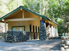
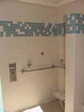
Orchard Hill: Campsites #30, #37, #39, and #58 are designated accessible and are usable in dry weather. Site #58 has an asphalt pad in the campsite. Assistance may be needed with the water, trash, and cooking facilities. An accessible combination restroom with showers is near site #37. An accessible unisex toilet and shower room is also near site 58. Accessible parking is near both restrooms.
Creekside: Campsites #15 & #21 are designated accessible and are usable in dry weather. Site #21 has an asphalt pad in the campsite. Assistance may be needed with the water, trash and cooking facilities. An accessible restroom with showers is located near site #15. Accessible parking is near the restroom.
Madrone Cabins: The Madrone area, set at the bottom of the grassy hills of Mount Barnabe, features 5 rustic alternative camping cabins, 2 of which are accessible (cabin #4 and #5). Visit Access Northern California for detailed cabin accessibility information and photos.
Picnic Area
Azalea Picnic Area: This level shady area just beyond the entrance kiosk is on fairly compacted earth and may be usable in dry weather. Accessible restroom with showers and adjacent accessible parking are available.
Trails
The South Creek Trail is an ‘out-and-back’ accessible trail that is 0.82 miles each way that offers an intimate walk along Lagunitas Creek past the historic dam and paper mill sites. Seasonally, visitors can view spawning salmon in the creek from vantage points along the trail. The surface is compacted soil and is usable year-round. There are several armored crossings on the trail that water flows over the trail during rain events that might be challenging for some users. The trail is generally flat at less than 5% slopes with intermittent sections between 5% to 8%. Accessible parking is available at the Creekside Campground restroom building adjacent to the Cross Marin Trail.
The Cross Marin Trail is a paved and unpaved multiple-use trail operated by the Marin Water District that passes through the park for 3.5 miles. The trail is generally accessible and includes some interpretive panels at historic sites. Accessible parking is available at the Azalea day use and Redwood Grove group picnic areas.
Accessible Trail Data
| Trail Name |
Running Slope |
Cross Slope |
Trail Width |
Trail Surface |
| South Creek Trail |
3% Average |
2% Average |
5 FT Average |
Rock, Soil, & Wood |
| 8% Maximum |
3% Maximum |
5 FT Minimum |

|
For more information: access@parks.ca.gov | Phone: (916) 445-8949 | Fax: (916) 449-8966
|
|
|
|
|


